Official information issued by tropical cyclone warning centers describing all tropical cyclone watches and warnings in effect along with details concerning tropical cyclone locations, intensity and movement, and precautions that should be taken.
Cyclone:
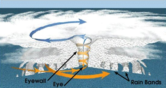
A close approach of a tropical cyclone to a particular location. Eye:
The roughly circular area of comparatively light winds that encompasses the center of a severe tropical cyclone. Eyewall/Wall Cloud:
An organized band or ring of cumulonimbus clouds that surround the eye, or light-wind center of a tropical cyclone. Hurricane / Typhoon:
The term hurricane is used for Northern Hemisphere tropical cyclones east of the International Dateline to the Greenwich Meridian. Hurricane Local Statement:
Hurricane Warning:
Because hurricane preparedness activities become difficult once winds reach tropical storm force, the hurricane warning is issued 36 hours in advance of the anticipated onset of tropical-storm-force winds.
Hurricane Watch:
An announcement that hurricane conditions (sustained winds of 74 mph or higher) are possible within the specified area. Because hurricane preparedness activities become difficult once winds reach tropical storm force, the hurricane watch is issued 48 hours in advance of the anticipated onset of tropical-storm-force winds.
Indirect Hit:
Because the strongest winds in a tropical cyclone are not located precisely at the center, it is possible for a cyclone's strongest winds to be experienced over land even if landfall does not occur.
Major Hurricane:
Radius of Maximum Winds:
The distance from the center of a tropical cyclone to the location of the cyclone's maximum winds. Saffir-Simpson Hurricane Wind Scale:
Storm Surge:
Tropical Depression:
A tropical cyclone in which the maximum sustained surface wind speed is 38 mph or less.
Tropical Storm:
A tropical cyclone in which the maximum sustained surface wind speed ranges from 39 mph to 73 mph.
Tropical Storm Warning:
An announcement that tropical storm conditions (sustained winds of 39 to 73 mph) are expected somewhere within the specified area within 36 hours.
Tropical Storm Watch:
An announcement that tropical storm conditions (sustained winds of 39 to 73 mph) are possible within the specified area within 48 hours.
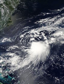
The National Weather Service has issued a tropical storm warning for waters off Beaufort County, along with southeast South Carolina and southeast Georgia, as Hurricane Irene moves from the Bahamas toward North Carolina.
Earlier today, the S.C. Emergency Operations Center issued a release about a tropical storm watch.
It was a Category 3 storm with maximum sustained winds near 115 mph and higher gusts. "Irene is a very large hurricane. "Winds of tropical storm force, greater than 39 mph, were already being observed off the coast of northeast Florida. These windswill continue to move north tonight and will push into the tropical storm warning area late tonight into Friday."Maximum winds expected over Horry County will be 30-40 mph on Saturday."
Maximum sustained winds were at 115 mph, or Category 3. The Weather Service Hurricane Center at 5 p.m. Thursday issued a tropical storm warning for the coast of South Carolina from Edisto Beach northward to Little River Inlet.
"Irene is a large tropical cyclone. Hurricane force winds extend outward up to 80 miles (130 km) from the center, and tropical storm force winds extend outward up to 290 miles (465 km)," the Weather Service said.